Spear-O-Wigwam Logo 2021

We do offer (limited) Shuttle services to and From the Sheridan county airport for an additional $80 fee each way. daily flights via United Airlines into shr arrive at 9:20am and 10:20pm. The Next closest airport is Billings-Logan International (3 Hours from Spear-O.) 

We are a very remote mountain lodge up steep and windy roads. Mountain driving experience is encouraged. We do not recommend navigating in the dark. Best western is our partner hotel in Sheridan if you feel like you can’t arrive before dark. We’d be happy to assist You in making arrangements. 

Directions to
Spear-O-Wigwam

Spear-O-Wigwam is a remote lodge in the heart of the Bighorn National Forest. The path to Spear-O will lead you on a gravel Forest Service Road either route you choose. We are less than 10 miles from the Cloud Peak Wilderness. 

Spear-O is about halfway between Yellowstone National Park and the Mount Rushmore National Memorial.

Getting to Spear-O

FROM THE EAST

Sheridan, Buffalo, Gillette

Shorter, Rugged

Red Grade – Forest Road 26

Steep, rugged, gravel road from Big Horn. Challenging. Mountain driving experience recommended.

  1. South on US 87 / Coffeen Ave for 3.3 miles
  2. South on WY 335 (stay right @ the Y) for 10.6 miles
  3. WY 335 becomes CR 26 / Red Grade Rd for 9.7 miles
  4. It is 16.9 miles from Big Horn High School to the turnoff to Spear-O-Wigwam.
  5. At the turnoff, there is a sign pointing to Park Reservoir, Coffeen Park, and Cross Creek Campground (FS293).
  6. South / Left onto FS293 for 4 miles.
  7. Slight Left into Spear-O

Longer, Scenic

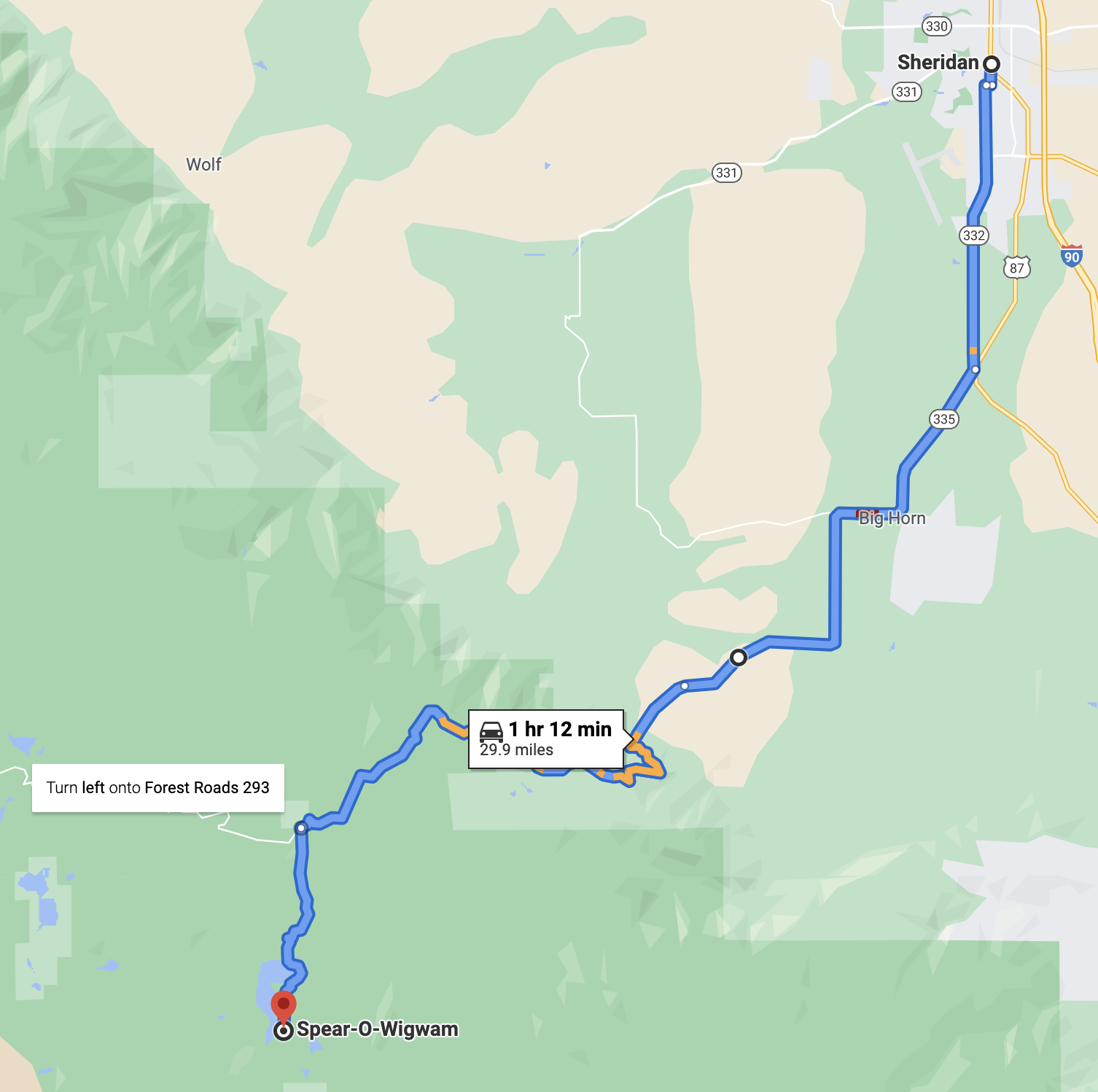
Bighorn Scenic Byway to Forest Service Road 26.

Paved road to the west end of Forest Road 26. Plenty to see on the way. Relax and enjoy the mountains. 72 miles and about 3 hours.

  1. I-90 W toward US-14 W/Billings 
  2. Take exit 9 for US-14 W towards Ranchester and Dayton for 14.4 miles
  3. Turn left onto US-14 W.
  4. Take US-14 W—veering to the left at Burgess Junction—to Forest Service Road FS26.
  5. Turn left onto FS26 towards Tie Plume and Dead Swede campgrounds for 24 miles.
  6. Turn right onto FS293 for 4 miles.
  7. At the turnoff, there is a sign pointing to Park Reservoir, Coffeen Park, and Cross Creek Campground (FS293).
  8. Slight Left into Spear-O

FROM THE WEST

Yellowstone/Cody/Greybull

From Greybull on US-14

  1. Head toward the Bighorn Mountains on US-14 for 25 miles
  2. Turn right onto FS 26 towards Tie Flume and Dead Swede campgrounds
  3. Continue for 24 miles on a gravel road
  4. Turn right onto FS 293, toward Spear-O-Wigwam & Park Reservoir
  5. Stay on FS Road 293 for 4 miles and arrive at Spear-O

Lovell

From Lovell on US-14 Alternate – Closed in winter

  1. Go east on US-14 ALT for 52 miles
  2. Turn right at Burgess Junction onto US-14 W
  3. Take US-14 W for 5 miles
  4. Turn left onto FS 26 towards Tie Flume and Dead Swede campgrounds
  5. Continue for 24 miles on a gravel road
  6.  Turn right onto FS 293, toward Spear-O-Wigwam & Park Reservoir
  7. Stay on FS Road 293 for 4 miles and arrive at Spear-O